

.jpeg)
.jpeg)
.jpeg)
.jpeg)


Welcome to
AgriSpatial
LIMA NASI EPUKA HASARA
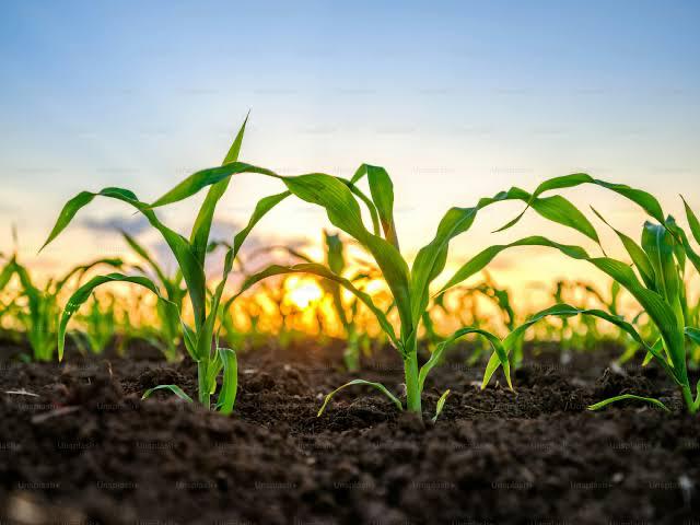
Tanzania's geospatial Agri-tech company — empowering farmers with satellite intelligence, drone surveys and AI-driven insights to grow more, spend less and build climate resilience.
Agriculture
Where Geospatial Intelligence Meets the Farm
AgriSpatial is a geospatial-focused Agri-tech company that harnesses spatial data from satellite imagery and drone surveys to deliver precision agriculture solutions. We use geospatial intelligence to craft smart, insight-driven strategies that tackle agricultural challenges and support sustainable growth.
By integrating Remote Sensing and GIS, AgriSpatial empowers farmers with actionable insights to boost productivity, use resources more efficiently, reduce operational costs and build resilience against climate change — from data collection and analysis to continuous monitoring and tailored recommendations.
Mission & Vision
Our Mission
To empower farmers with advanced Geographic Information Systems (GIS) and Remote Sensing (RS) technologies, enabling data-driven, evidence-based agricultural decision-making. We collaborate with agronomic experts to assess crop requirements, analyze satellite and aerial imagery, monitor plant health, evaluate climatic conditions and identify optimal zones for diverse crop production.
By partnering with academic institutions, government agencies and media platforms, we build geospatial literacy among agricultural professionals and extend actionable intelligence to farming communities across Tanzania.
Our Vision
To transform agriculture in Tanzania by ensuring that every farmer, regardless of farm size, has access to geospatial intelligence through GIS and Remote Sensing.
We aspire to create highly productive, environmentally sustainable and climate-resilient farming systems that contribute to national and global food security.
Our Core Services
Complete geospatial solutions for modern, climate-resilient agriculture
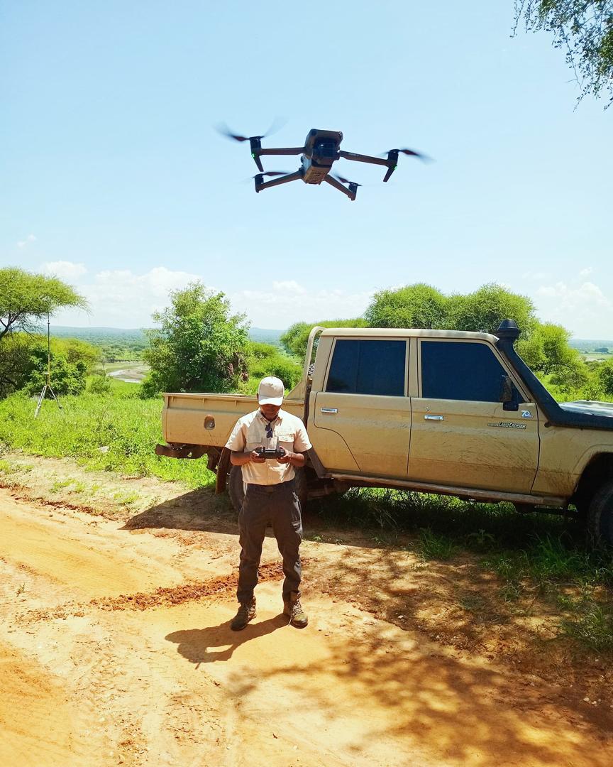
Satellite & Drone Imagery
High-resolution imagery from satellites and drones for accurate farm mapping, crop health monitoring and seasonal change detection.
- Multi-spectral aerial imaging
- Crop canopy analysis
- Seasonal change tracking
NDVI Crop Health Analysis
Detect crop stress, disease and irrigation deficiency early using Normalized Difference Vegetation Index satellite analysis.
- Early stress detection
- Yield prediction models
- Field zone management
Soil pH & Nutrient Mapping
Geospatial soil analysis delivering detailed pH and nutrient maps so you apply inputs precisely — saving costs and boosting yields.
- GIS soil sample mapping
- Fertilizer prescription maps
- pH correction planning
Climate & Weather Analytics
Localized climate monitoring and historical weather data to guide planting calendars, irrigation scheduling and risk management.
- Rainfall pattern analysis
- Temperature trend forecasting
- Drought & flood risk maps
AI Crop Recommendation
Our intelligent engine analyzes soil, climate, market prices and historical yields to recommend the best crops every season.
- AI-powered crop matching
- Market-linked variety selection
- Rotation planning support
Farm GIS Mapping & Registration
Professional GPS boundary surveys and GIS farm maps for land tenure, certification, insurance and investment documentation.
- GPS boundary demarcation
- Digital farm certificates
- Land use planning maps
How AgriSpatial Works For You
Farm Assessment
We visit your farm or gather remote data to understand your land, crop types and specific challenges.
Data Collection
Drone flights, soil sampling, satellite imagery and GPS surveys capture precise field data.
GIS Analysis
Our team processes data using GIS, AI and agronomic models to produce actionable maps and reports.
Advisory & Monitoring
We deliver recommendations, support implementation and continuously monitor field performance.
Try Our Farm Analysis Tools
Instant geospatial insights — available to every farmer right now
Our Leadership Team
A multidisciplinary team of geospatial engineers, agronomists and strategists driving Tanzania's precision agriculture transformation
Chegenya Chegenya
Founder & Chief Executive OfficerLeads AgriSpatial's strategic direction, integrating GIS, remote sensing and spatial analytics to translate environmental and agricultural data into practical insights for farmers, institutions and decision-makers across Tanzania.
Gerald Mafuru
Co-Founder · Head of Geospatial SystemsLeads development of AgriSpatial's geospatial analysis frameworks and spatial intelligence tools — transforming satellite observations and environmental datasets into practical analytical systems that support agricultural monitoring.

Cosmass Peter
Co-Founder · Director of Strategy & PartnershipsConnects geospatial intelligence with agricultural stakeholders, institutions and development partners to expand the application of spatial data in agricultural planning and support data-driven sustainable systems across Tanzania.

Samwel Isack
Geospatial Software EngineerDesigns and implements geospatial software solutions, spatial algorithms and GIS tools powering AgriSpatial's analytical platforms — ensuring satellite data and spatial models are transformed into reliable agricultural decision-support systems.

Olais Thobias
GIS Specialist · UAV OperationsManages AgriSpatial's drone operations and aerial data acquisition — conducting UAV-based mapping, high-resolution spatial data collection and aerial monitoring to support geospatial analysis and agricultural field assessments.

Elton
GIS & Remote Sensing SpecialistProcesses and analyzes Earth observation datasets to generate analytical outputs that support agricultural monitoring, environmental assessment and spatial intelligence services — converting complex satellite data into actionable geospatial products.